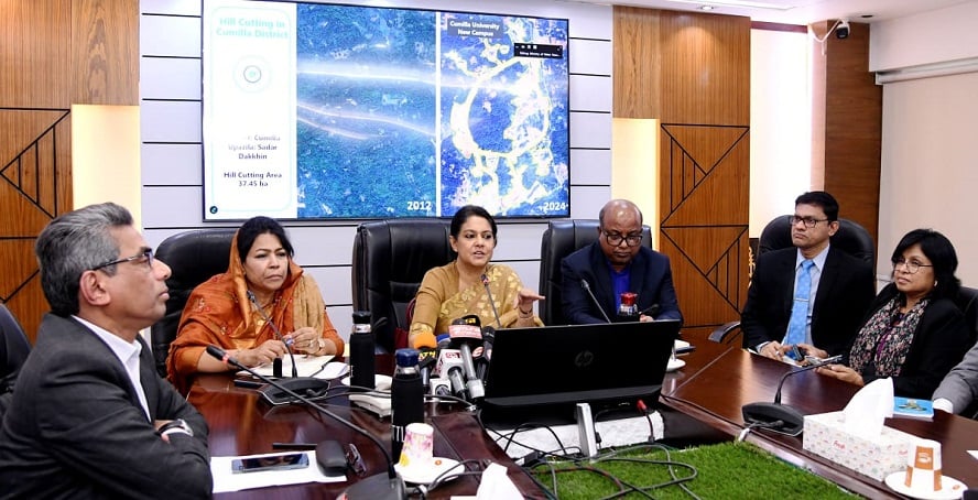
Advisor to the Ministry of Environment, Forest and Climate Change, Syeda Rizwana Hasan, has announced that the government is taking steps to use advanced technology in monitoring and preventing hill and hillock cutting. She made the statement while addressing a progress review meeting on the formulation of a map of the country’s hills, hillocks, and other natural resources at the Ministry of Water Resources in Bangladesh Secretariat on Wednesday.
The advisor mentioned, “For this task, high-resolution WorldView-3 satellite imagery (30 centimeters) is being used. This is being used to create a map of the natural resources in the hilly areas. The boundaries of the region have been further refined with the use of Digital Terrain Models (DTM). Satellite images from Google Earth from 2004 to 2024 are being analyzed to identify environmental and land changes caused by hill cutting.”
She further informed that the government is working on creating a comprehensive map and integrated forest management plan to ensure sustainable land use and proper management of natural resources. This initiative will help in conserving resources such as forests, rivers, and wetlands, as well as contribute to carbon sequestration, flood control, biodiversity preservation, and environmental improvement.
The advisor added, “The extent of hill cutting and environmental damage is being calculated in hectares. The GIS and Remote Sensing teams will verify this on the ground through consultations with the CHT Board, regional councils, and local communities.” This project reflects the government’s commitment to preserving Bangladesh’s natural heritage, managing resources effectively, and promoting sustainable development.